Baffins, a Ward in the eastern part of Portsmouth, was originally part of the extensive estates of the Wymering Manor. The land was primarily used for farming until the early 20th century, when the steady eastward expansion of Portsmouth transformed Baffins into a suburban neighbourhood, characterised by terraced housing built from locally-sourced red brick. The centrepiece of the area is Baffins pond, a former farm reservoir that was preserved as a public park and remains a popular recreational spot.
Aerial view of Baffins
Todo
I’d like to find the original source for this image - it’s not in Britain From Above. It’s been desaturated at some point on its travels but the grain makes me think it’s originally from a printed source rather than being a copy of a photograph).
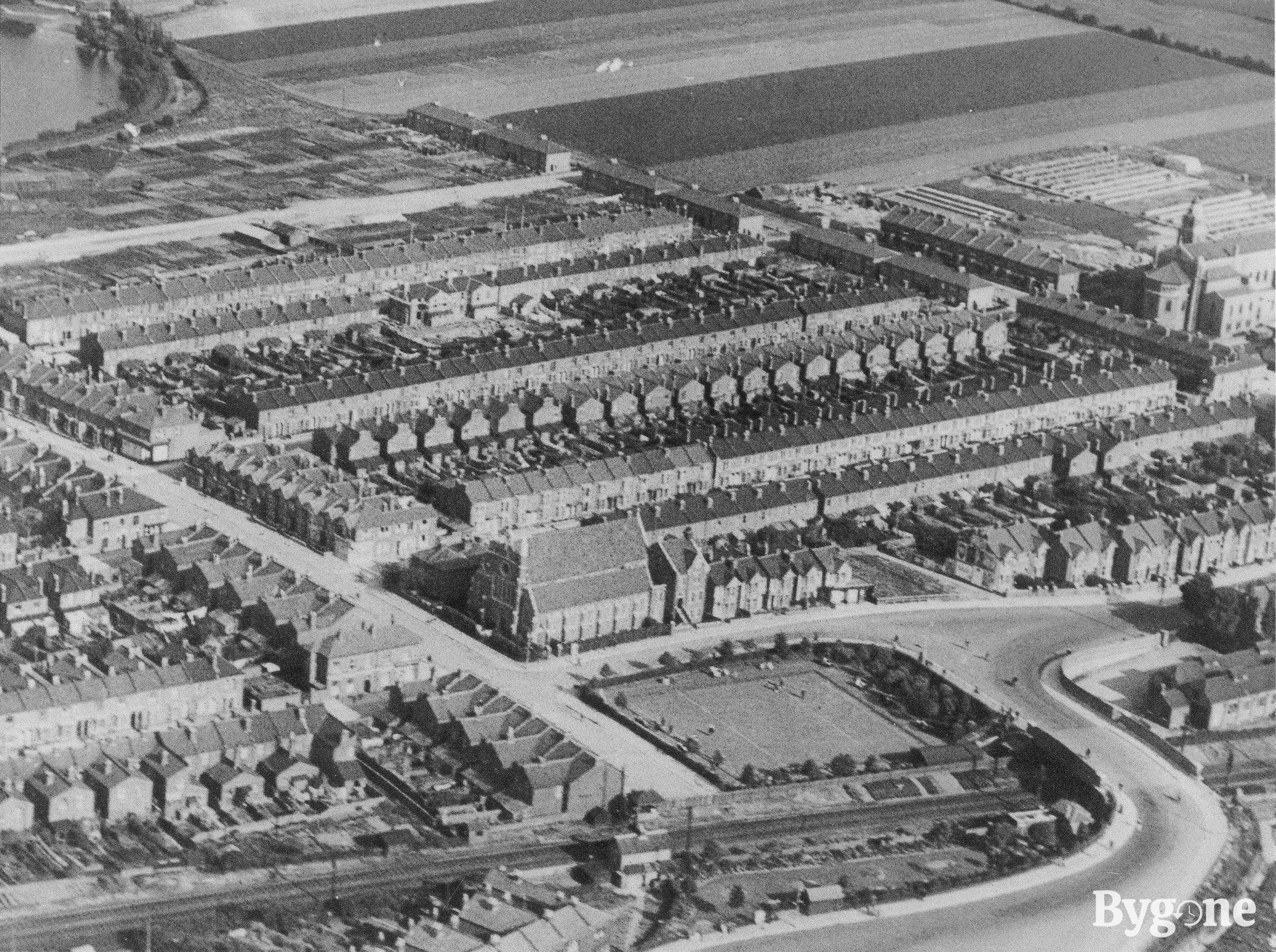
This is a snapshot of Baffins in the process of being built. North is at roughly 8 o’clock. There’s a lot of detail here if you look carefully: St Joseph’s is centre along with the bowling green, but in the top-right is St Cuthbert’s1, with its original pre-WWII north end intact and the original houses opposite. Hayling Avenue is mostly unbuilt, and the roads south of it are still fields. The roads between Hayling Avenue and Tangier Road are laid out, and the houses are under construction. Top-left we just catch the corner of an unimproved Baffins pond, and bottom-centre we see Tangier Road ending in a level crossing. Bottom right, right of Copnor bridge, is the tannery.
I’m intrigued by the railway embankment - are we seeing cultivation there, just below the bowling green?
St Joseph’s, Tangier Road
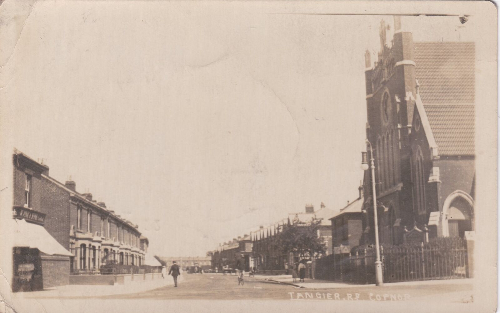
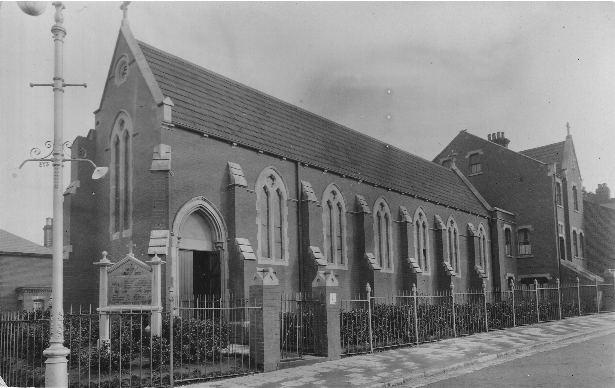
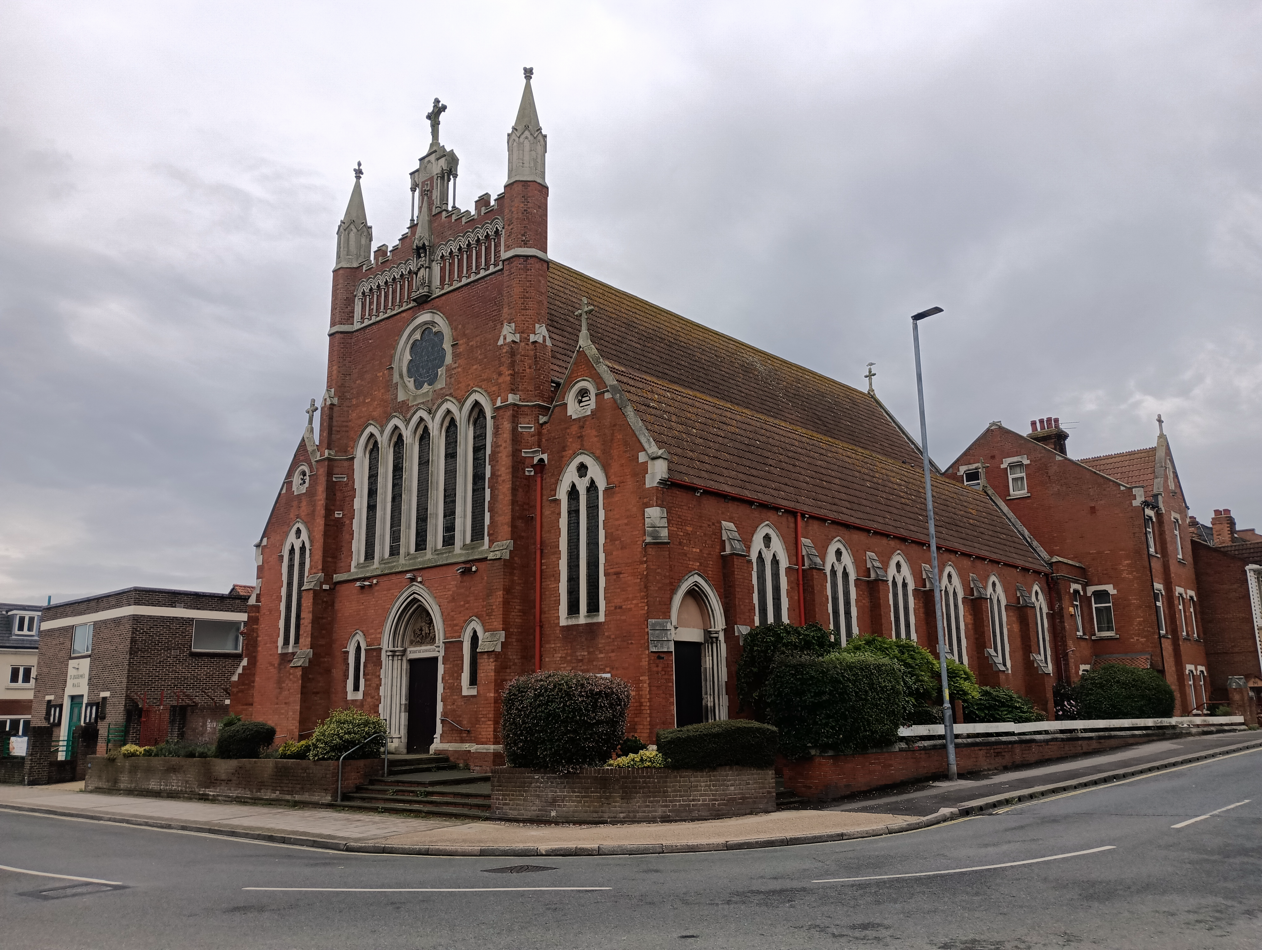
This image shows the presbytery behind the church, with its original steps leading up from street level, and the church only partially constructed. The presbytery and Lady Chapel were built in 1908, with the rest of the church following in 1913-14. The architect was A. J. C. Scoles, and the builder was Domenico Marchetti, a parishioner who built extensively in the diocese. Marchetti died in a collision with another cyclist after leaving the church in May 19182.
The modern church hall is on the site of the building with the portico in the bottom-left corner of the second image. It might be the most interesting thing in the picture - it seems to pre-date not just the church, but Tangier Road itself. Here it is on Tangier Lane, complete with portico, on the 1896 OS 25” map:
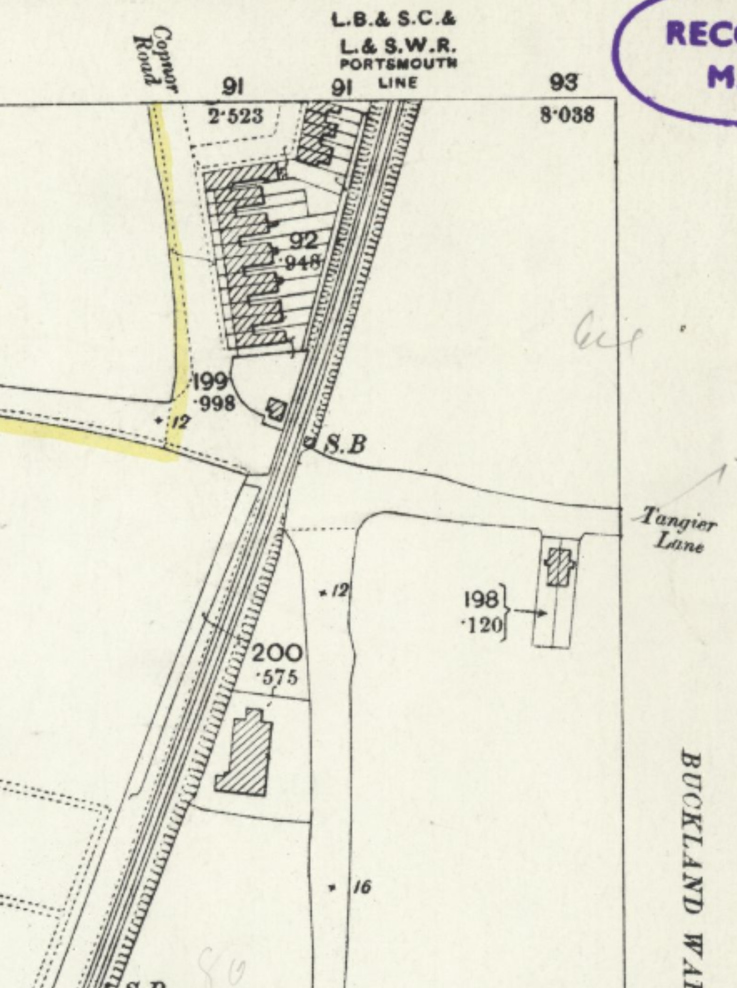
Note the lack of a bridge over the railway, and the tannery very sensibly sited well away from any other buildings. By the time of the 1933 OS map we’ve got the bridge, the church, the bowling green, and a whole lot of housing:
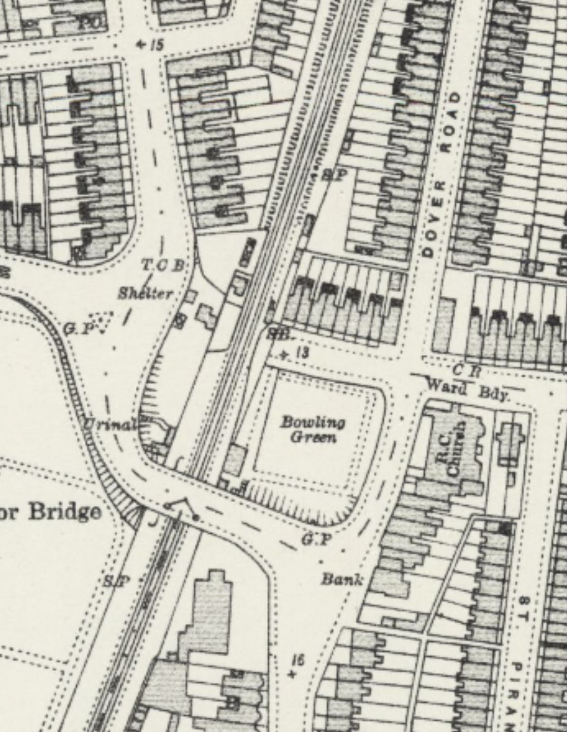
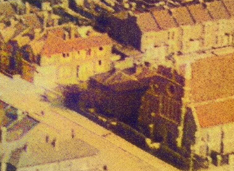
The earliest BNA reference I can find to St Joseph’s Hall is 1931, so the portico’d buildings had already been replaced by the church hall when this map was published. The maps suggest two houses with two gardens, but adding a dash of AI colour to the aerial image highlights a more complex roof line than I expected. I wonder if we’re looking at four cottages, possibly associated with Baffins Farm. If they survived until the end of the 1920s I’m hopeful there are better images of them out there somewhere, possibly in St Joseph’s archives.
The Dec 1945 aerial photo shows what I assume are water storage tanks at the western end of Tangier Road, just north of the bowling green.
Southsea Dairy Co, Tangier Road, Portsmouth
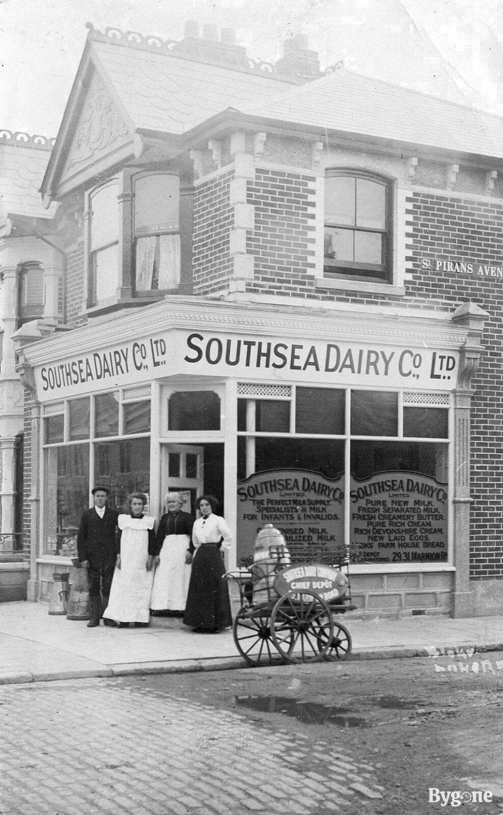
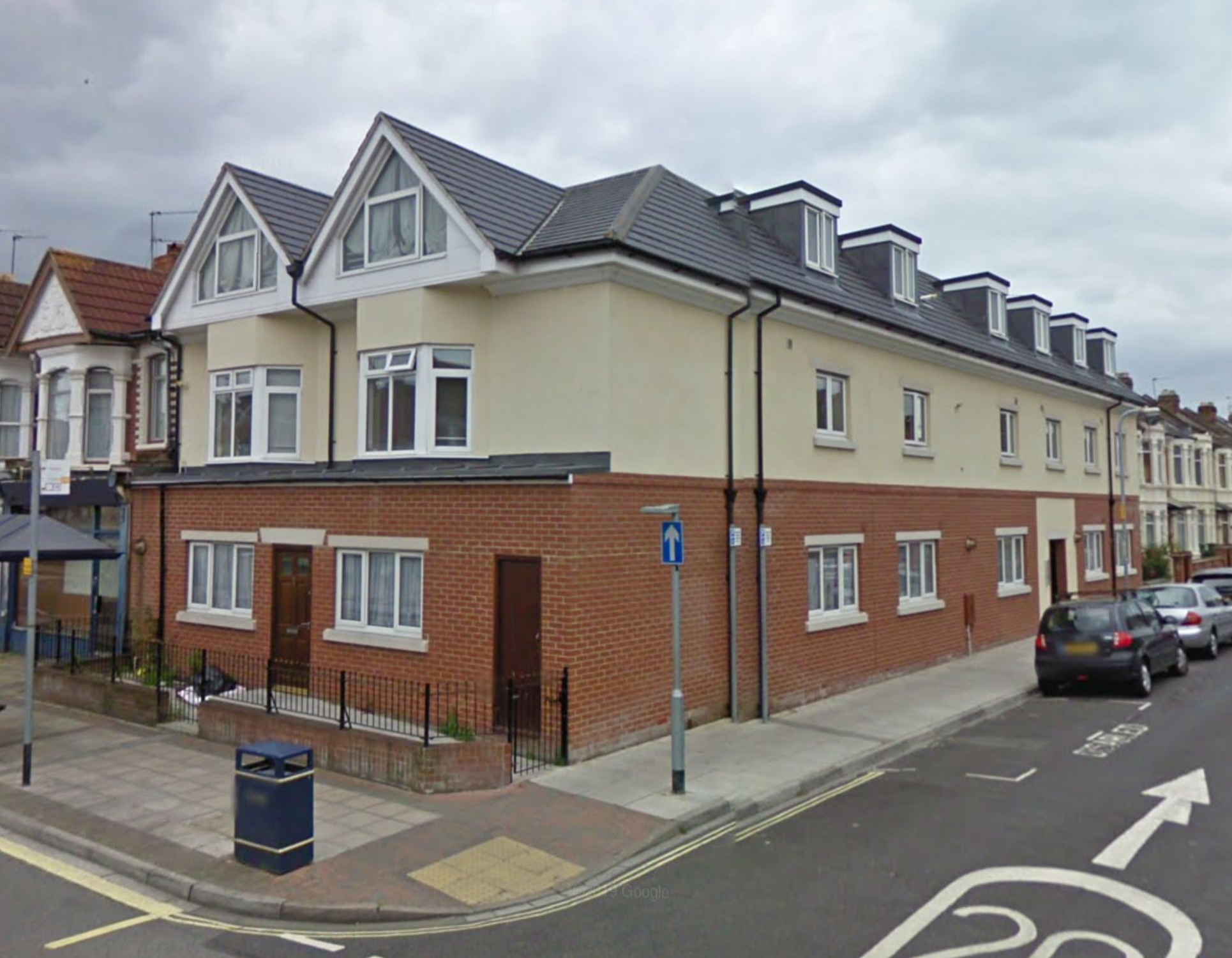
The other corner of the Tangier Road/St Pirans Avenue junction, also visible in the aerial photo above. The mixed paved/dirt road is interesting - I wonder if those bricks are still under the modern tarmac. When I was a kid it was a corner shop with accommodation above and at the back, but this plot and the one next to it have now been rebuilt as flats.
Baffins pond
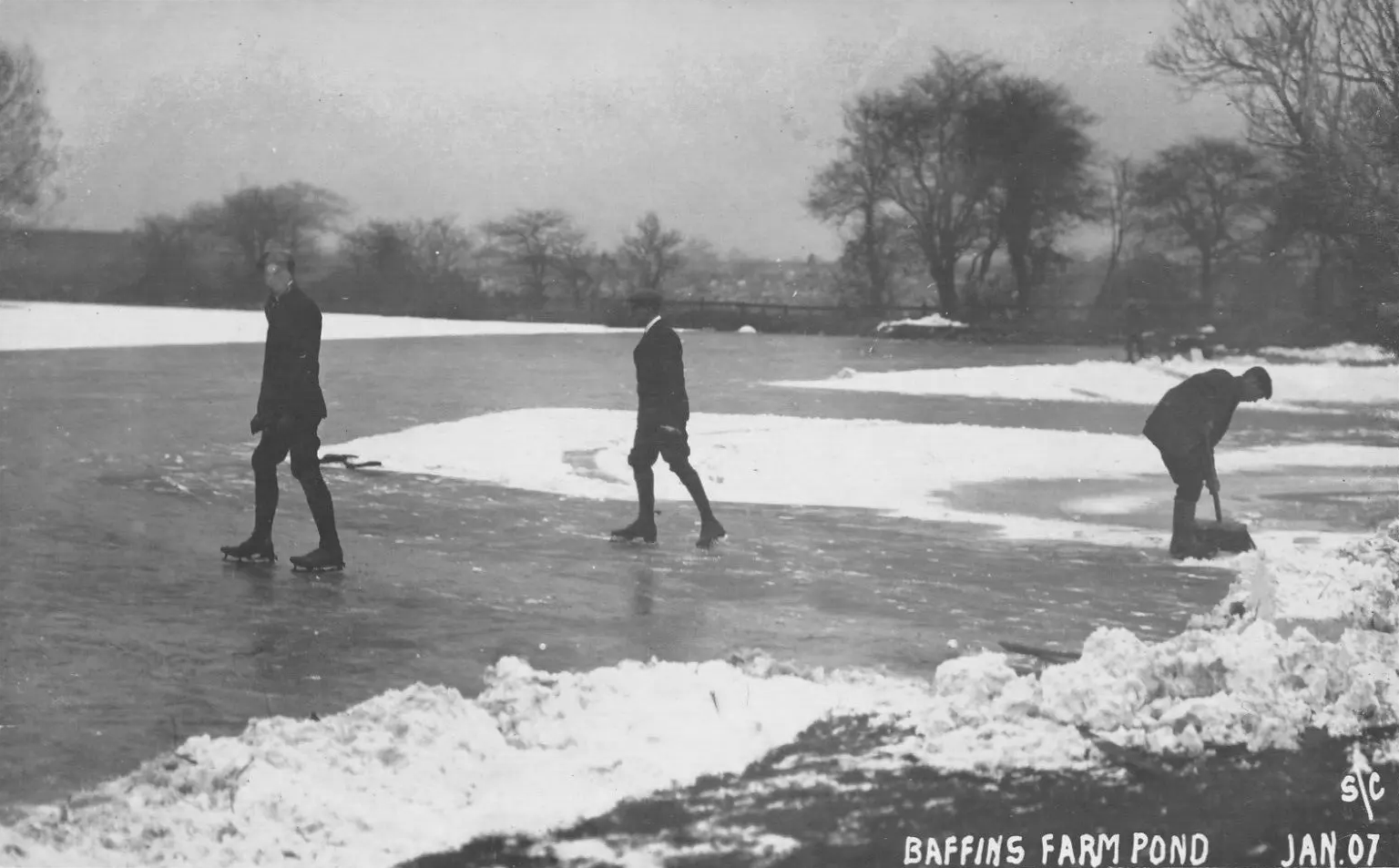
Hard to tell, but I think this must be looking north, towards the hill, before most of the housing was built. We could be seeing the old farmhouse behind the trees.
Tangier Road level crossing
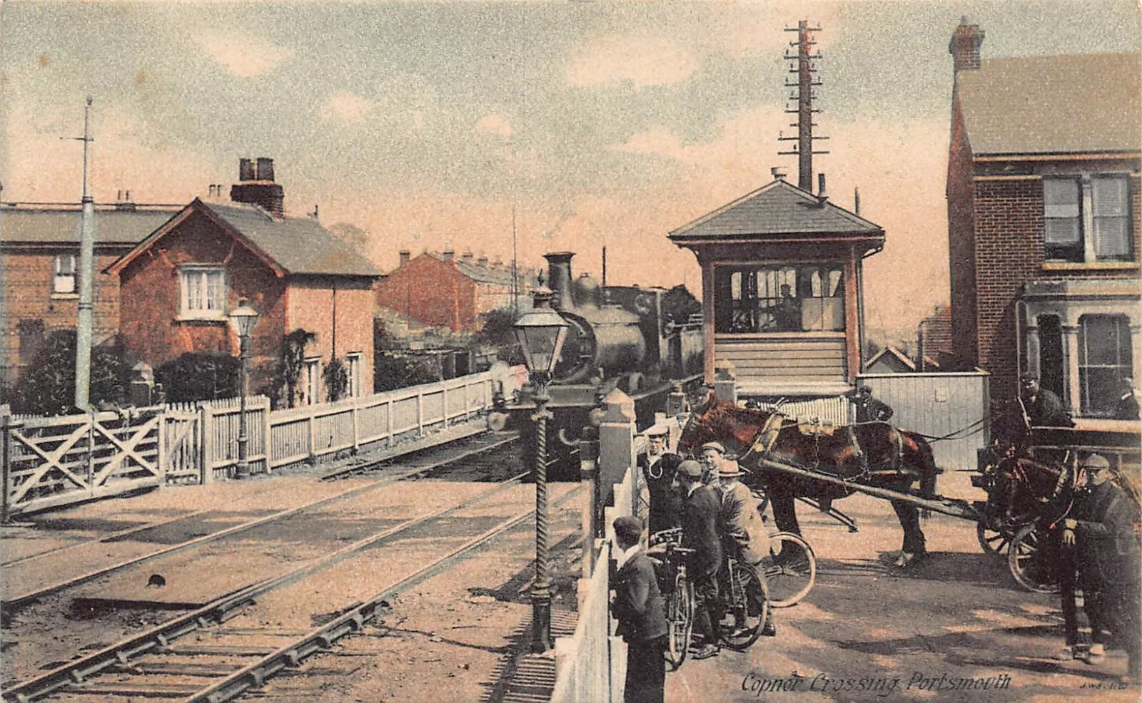
Suggested dates for this one float around a bit, but “c. 1905” is probably the best guess. Obviously it’s after this end of Tangier Road is built out, but before the level crossing is replaced with a bridge. I’ve never seen it without a divided back.
Railway cottage (the building on the left) was built in 18533, and can be seen on the maps above. Copnor Bridge was opened in July 19084, replacing the level crossing.
Langstone Road, Baffins
Velder Lake, Feb 1895

This lake, actually part of Langstone Harbour, was progressively reclaimed in the 20th Century, and is now Milton Common. The wall with regularly-spaced trees matches the rear wall of St. James’s Hospital, Milton.
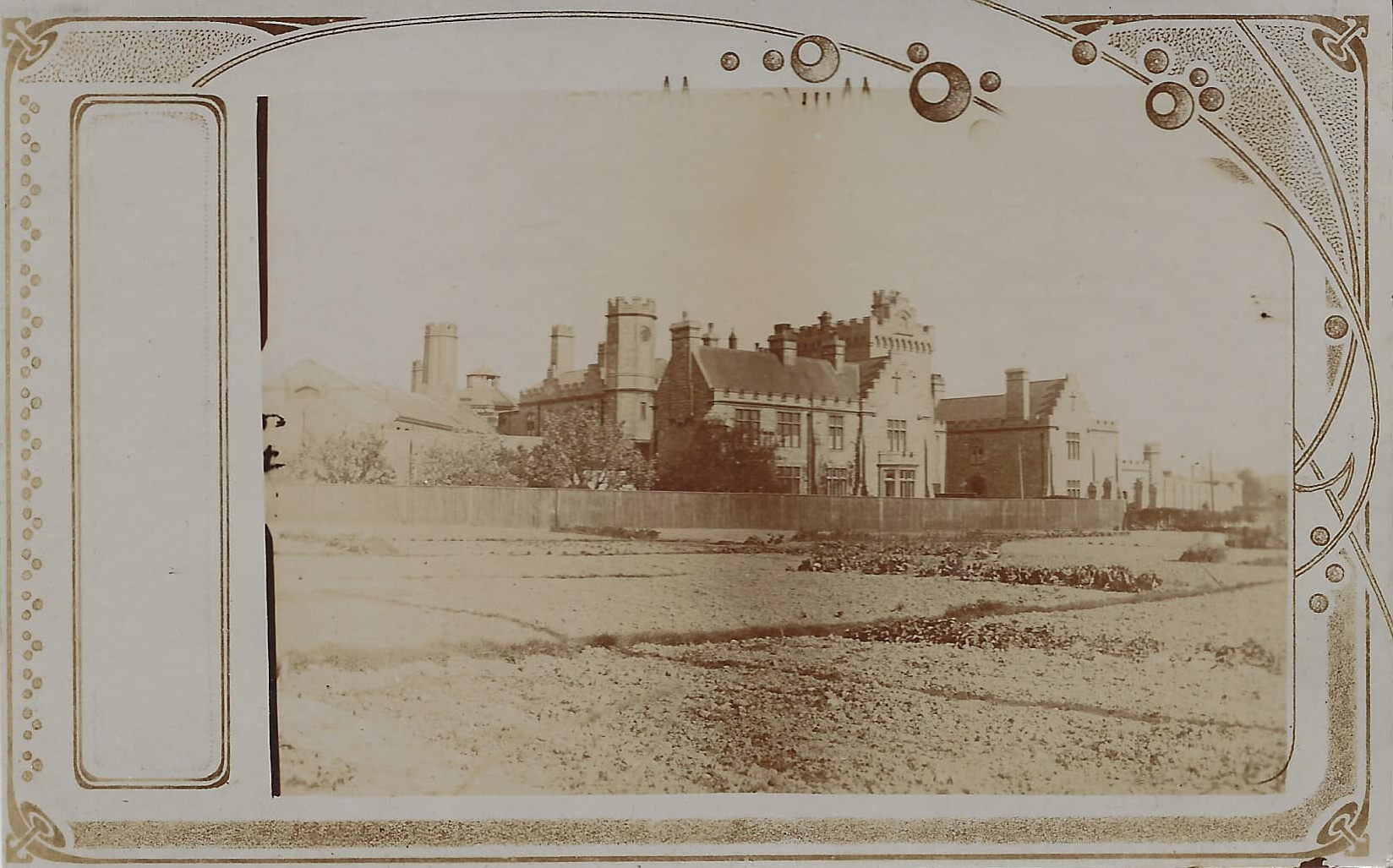
Kingston Prison, Portsmouth
