Note
The source has this down as 1730-1770, but I think we can do better than that (I’d be amazed if it was pre-1750). We might even be able to figure out who drew it. To be honest, I would have pegged it as much later, but… it doesn’t have the burial ground. I recommend opening the image in a new tab and zooming it so you can see the details.
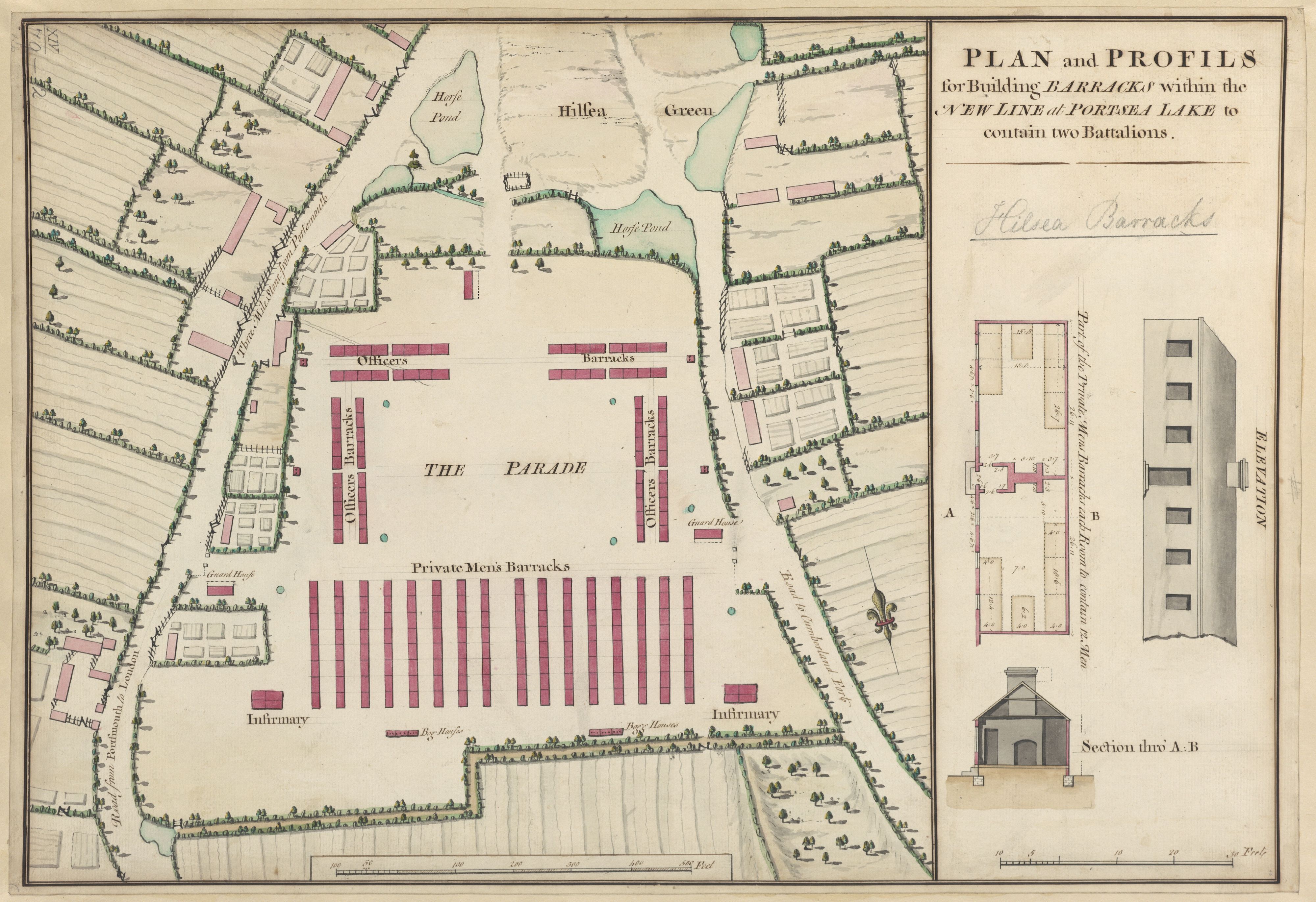
Plan and Profiles for Building Barracks within the New Line at Portsea Lake to contain two Battalions
— King George III’s personal collection of maps and views source
Note
Right at the bottom? South of the Private Men’s Barracks? “Bog Houses”.
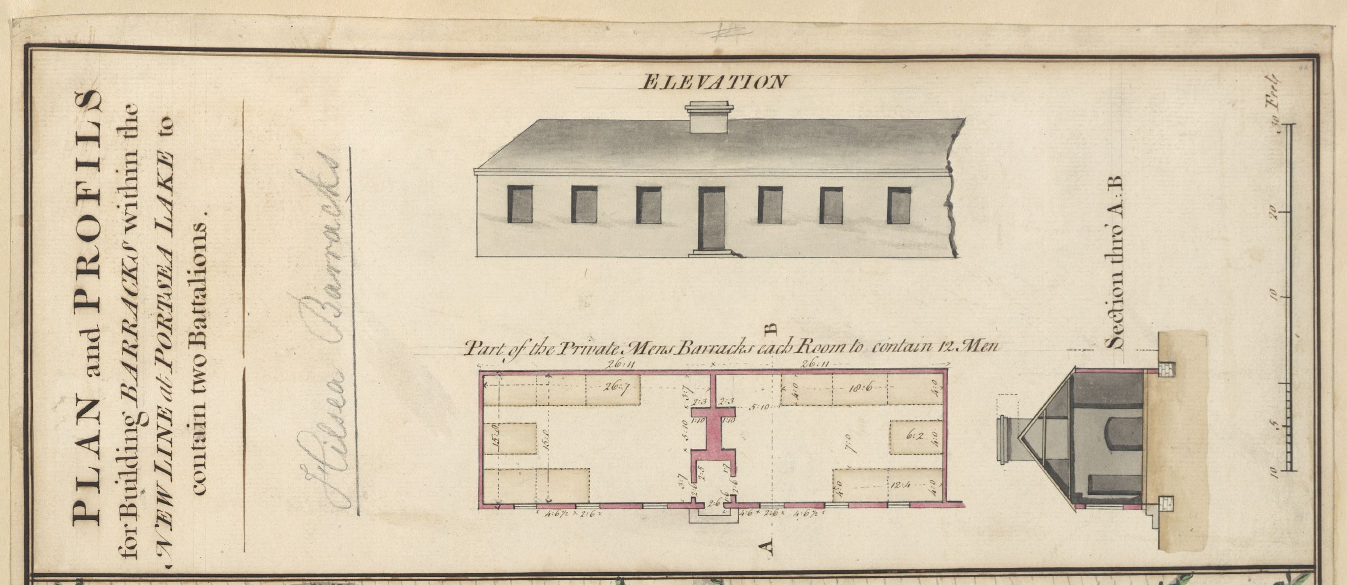
Part of the Private Men’s Barracks each Room to contain 12 Men
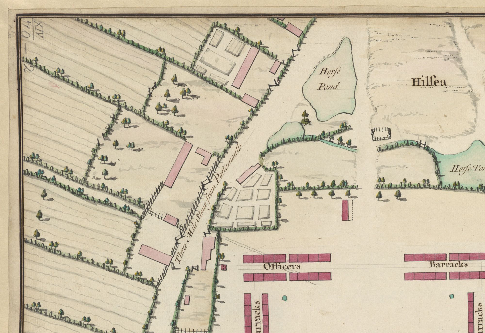
Three Mile Stone from Portsmouth
Note
There’s a pound on Hilsea Green - so presumably that’s the “small Piece of Waste Land, lying between the said Land of the said William Goldfinch, hereinbefore described, and the Turnpike Road aforesaid, containing by Statute Measure Thirty eight Perches or thereabouts, on Part of which the Public Pound lately stood” in 1813.