A Solid Silver Yacht
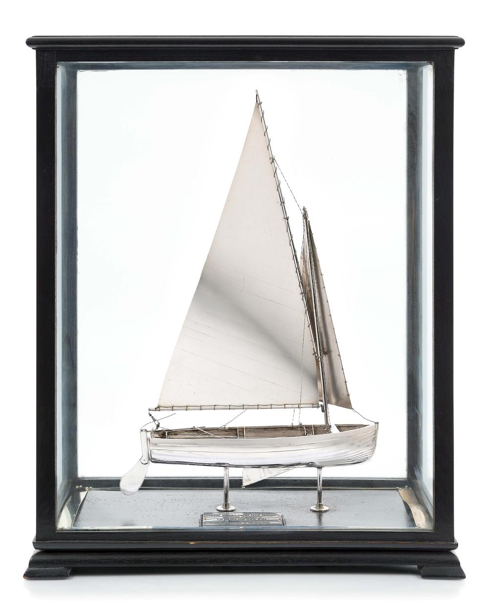
“comprising a silver model of sailing dinghy with drop keel, rudder, clinker hull and sails set, mounted in ebonised display case with plate inscribed ROYAL ALBERT YACHT CLUB TROPHY / PRESENTED IN MEMORY OF C. E. NICHOLSON O.B.E. R.D.I. / BY HIS SON JOHN W. NICHOLSON, with winners on rim plates listed between 1955 and 1968 — 23 x 18½ x 10½in. (58 x 47 x 26.5cm.)”
Sold for £1,800 in 2022, now for sale for £14,500 over here. It’s a lovely thing, but that’s a hell of a markup. Better pictures on instagram. I’d like to find out who made it.
Yacht Poster
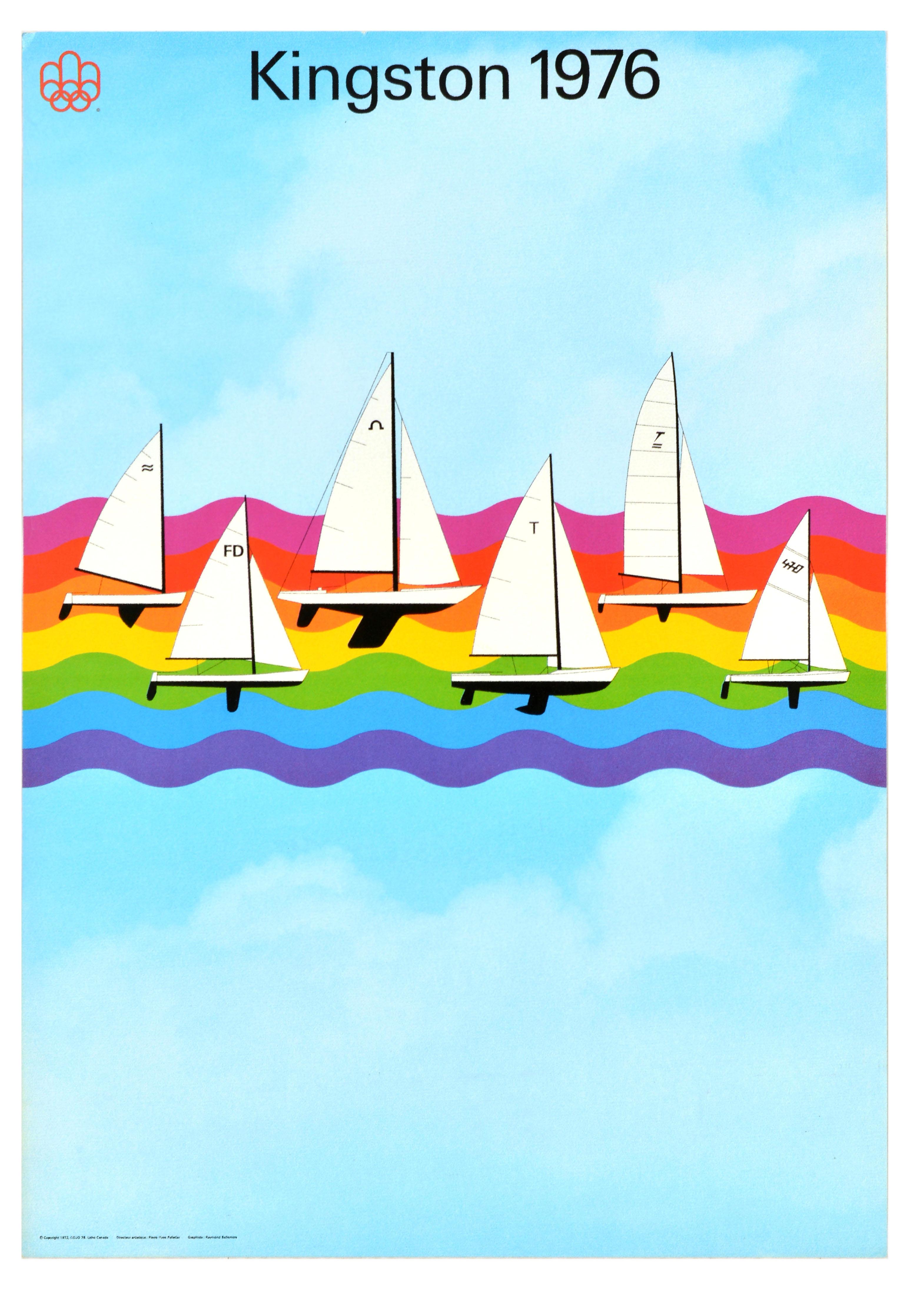
“Original vintage water sport poster for the XXI Olympic Summer Games 1976 held in Montreal Quebec Canada from 17 July to 1 August featuring an illustration by the graphic designer Pierre-Yves Pelletier (b 1938) depicting the different classes of yachts sailing on rainbow-coloured waves - a Finn, 470 and Flying Dutchman dinghy, a Tornado catamaran and a Tempest and Soling keelboat - set over a background of clouds in a blue sky with the Olympics logo in red and title text in black above - Kingston 1976.”
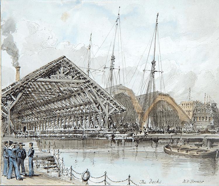
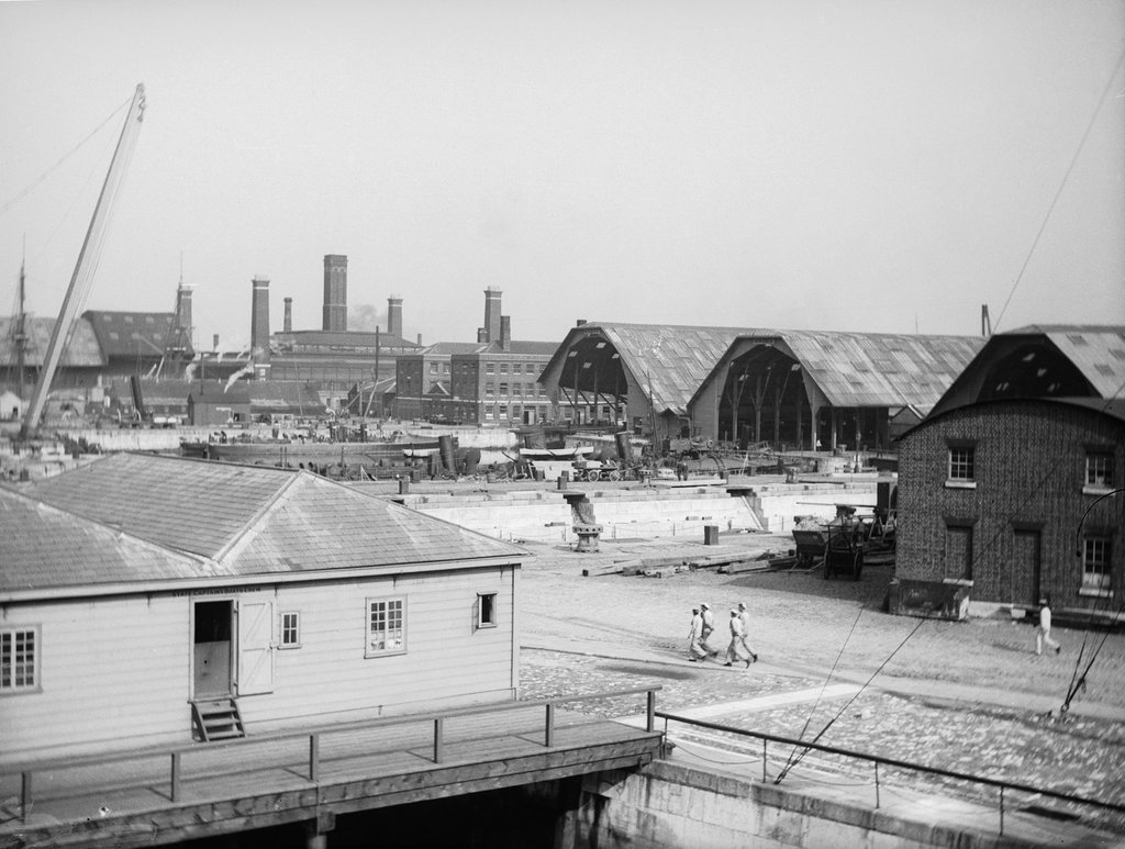
Dry Dock Sheds
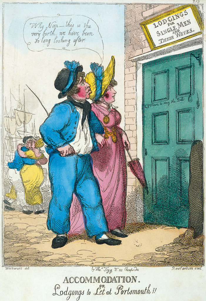
Lodgings for Single Men and Their Wives
1783 Chart showing about two thirds of Portsea
Resolution too low to be of use, and they want £60 for a non-commercial license. But it might be the most accurate early map of the inlets on the east side of the island I’ve seen. Ho hum. Never mind, it’s in Old Hampshire Mapped
Eastnee, Milton, Barvan. I’ve seen Copnor named B-something somewhere else recently. Hmm. Ok, yep, here we go: Batsland, 1712
c.1840 Chart showing Southsea, Landport, Dockyard
I can make out “bathing machines” and “five cricketers” but again, resolution too low to be useful.
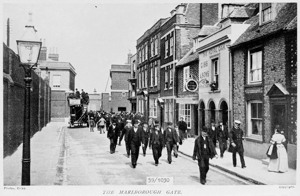
Decorative Flemish Bond there again. Same view c. 1930
Prison Hulks with Nets
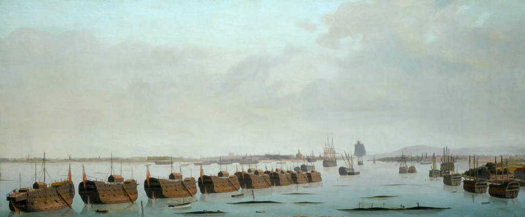
Something interesting going on with nets in the bottom-right corner. And what building would that be, far right? It doesn’t look like Portchester. Could it be Horsea?
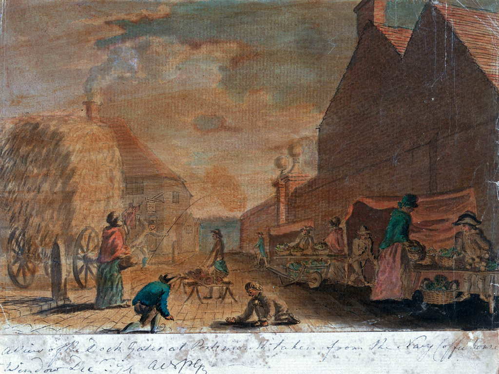
Interesting view raking along the wall, rather than pointing at the gates. In modern terms he’s in Queen Street, looking south towards Victory Gate. Very roughly here - although the height of the building on the right seems all wrong, its roofline is right. Can the tavern be identified? Can the Navy Coffee house be identified?
Reference to Parade Coffee House
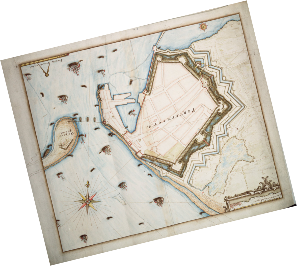
Early view of the Little Morass. No sign of Felton’s Gibbet, unfortunately.
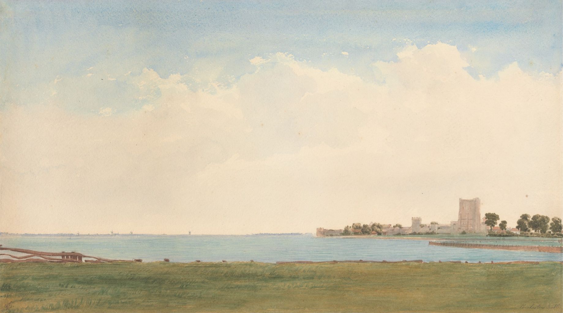
What would that sea wall be used for? I think, beyond the windmills, you can see St Mary’s. That would date the image post-1843, maybe later (need to find a picture of the second church to compare). The windmills might provide another terminus date.
